Photogrammetric data for planning, documentation and costing. QopterVision is not a surveying office, the data does not replace a survey by a licensed surveyor. The achievable accuracy depends on satellite reception, flight altitude, object geometry and processing, we do not promise a fixed accuracy. Hidden areas, for example under trees or roofs, cannot be captured from the air.
- 3D models of buildings and terrain
- Georeferenced orthophotos
- Areas and volumes for costing
Hundreds of overlapping aerial images are turned into a true to scale model of a building or terrain. With the RTK positioning of the DJI Matrice 4TD the data is georeferenced, with positional accuracy in the centimetre range under good reception conditions. This is often called a drone survey. It is a photogrammetric capture, not an official survey.
What the data is used for
- As built records of buildings and plots as a basis for planning and renovation
- Documentation of historic buildings and sites
- Areas and volumes of excavation or bulk material for costing
- Documentation of wildlife damage with orthophoto, area and date, the assessment lies with the responsible bodies
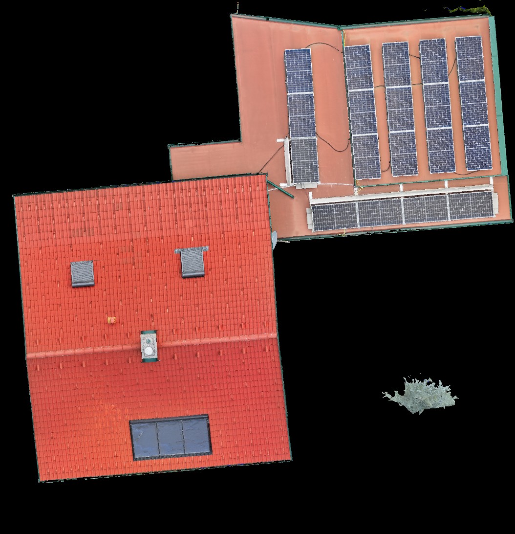
For roofs and construction sites
Roof measurement and ongoing construction site documentation have their own services: roof measurement with RTK and construction site documentation.
Your benefits
- One true to scale model instead of many individual measurements on site
- Georeferenced data, compatible with common CAD and GIS software
- Areas and volumes as a basis for quotes and billing
- Dated record of the condition, traceable for everyone involved
Applications
Buildings · Plots and terrain · Historic buildings · Wildlife damage
How it works
- 01Agreement on goal, area and required data
- 02Flight planning with RTK
- 03Flight on site
- 04Processing and delivery as 3D model, orthophoto or terrain model
Suitable for
Architects · Planners and engineering offices · Construction companies · Municipalities · Farmers · Hunters
A 3D model saves many measurements on site and shows everyone involved the same status.